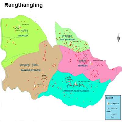
Rangthangling Gewog was earlier called as Chaunetai, which means a stone Grinder and it has been translated directly to Dzongkha term. It can be viewed from the top of the valley, above upper Rangthangling and the shape of the valley (Chaunetai) is like that of a Grinding stone machine typically used by the Bhutanese or lhotsam people for grinding the Maize.
The total area of Rangthangling Geog is 24.5 square kilometer. It comprises of 8 villages with 423 Hhs (including the separation of households) with Zhinem (old residents) and Zhesar (resettlements) and the total population is 2700 approximately with an altitude range of 600 to 1600 meters. The major crops or cash crops cultivated or grown in the Gewog are maize, rice, millet and orange. For the last three years the major cash crop grown is Ginger for the Rangthangling and onions for Sunkosh chewogs. From this year the Cardamoms are also planted in some villages under Rangthangling, Dhajay and Neymedsa and some residents have also started planting Mangoes in Sunkosh and Nimazor villages.
The Gewog office is located 4kms towards the southwest of the Dzongkhag and it is connected with a blacktopping. It experiences sub-tropical climatically and is covered with cool broad leaf trees with forest coverage of 80%.People in the Gewog avail health services from Damphu hospital though extension services are provided by the 02 ORCs in the Gewog. There are RNR extension offices in the Gewog Office which facilitates easier services from this centre.